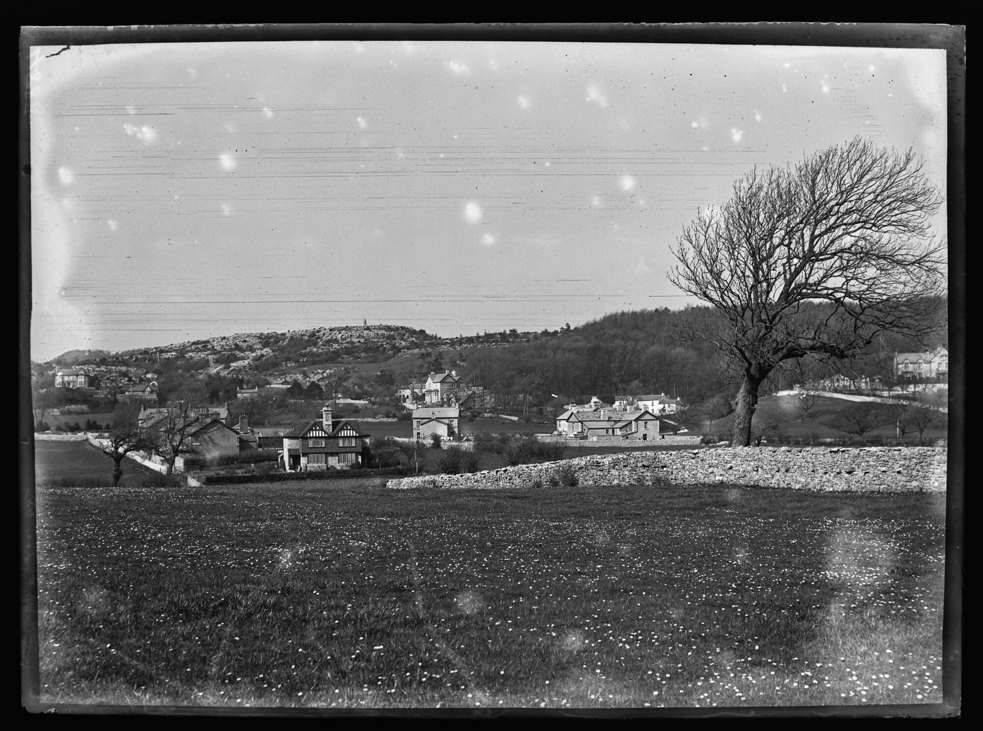
4838, BDB 86/1/1268 Sankey Family Photographic Archive © Cumbria Archives
no.4838
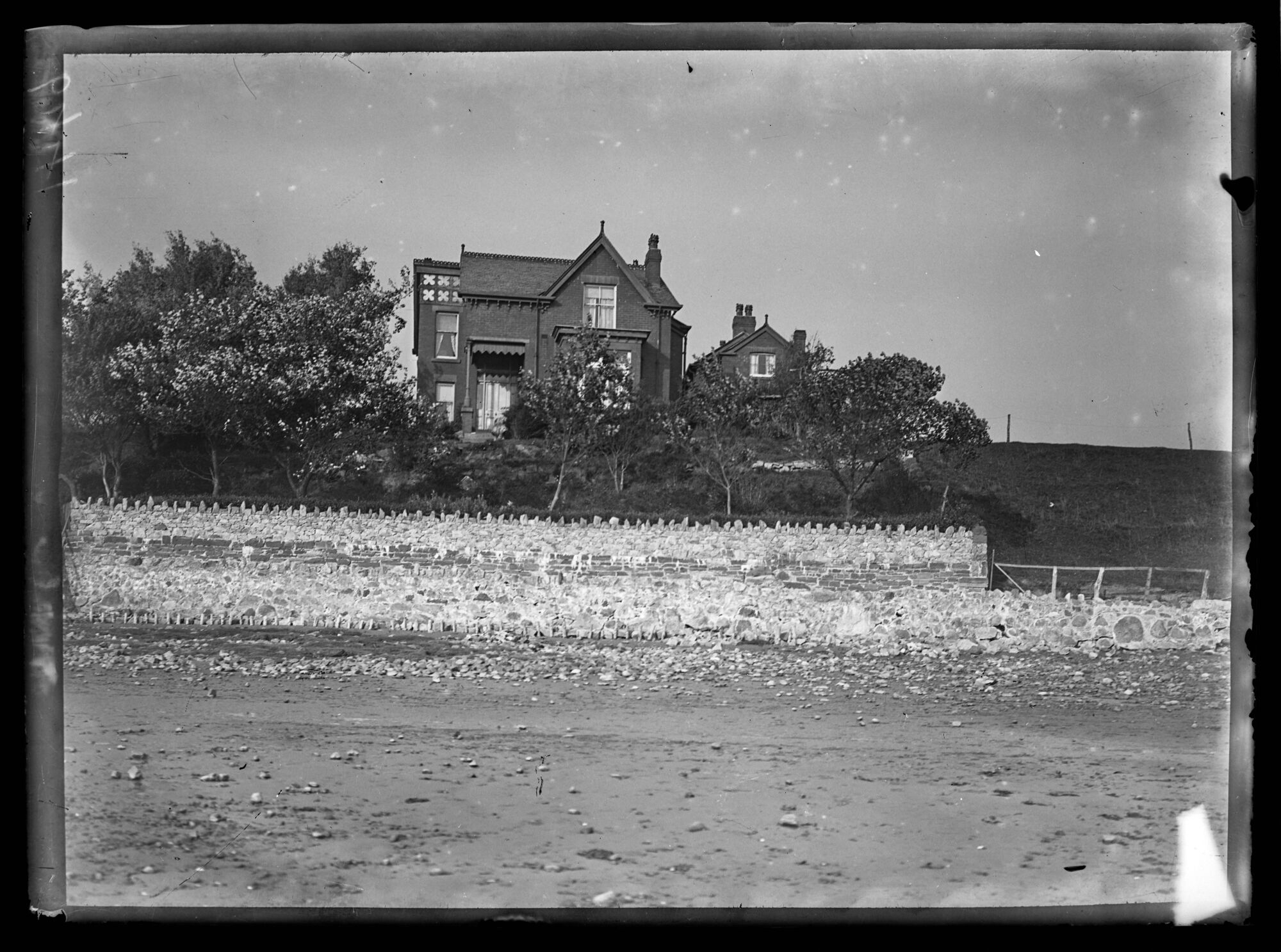
View of Silverdale from Church
Early 20th Century
Looking North across a field to the Queen Victoria Jubilee Monument at the top of King William's Hill in the distance. Field is bounded on the right by a dry stone wall. Mature tree to right with wooded hill behind. Several large houses of various styles and fields in the middle distance (the area known as Elmslack) before the rocky the escarpments that form King William's Hill.
4838, BDB 86/1/1268 Sankey Family Photographic Archive © Cumbria Archives
no.4838
View of Silverdale from Church
Early 20th Century
Looking North across a field to the Queen Victoria Jubilee Monument at the top of King William's Hill in the distance. Field is bounded on the right by a dry stone wall. Mature tree to right with wooded hill behind. Several large houses of various styles and fields in the middle distance (the area known as Elmslack) before the rocky the escarpments that form King William's Hill.
| Location: | Silverdale, Lancaster | Cumbria Archives Reference: | BDB 86/1/1268 |
|---|---|---|---|
| Sankey Number: | 4838 |
More Items
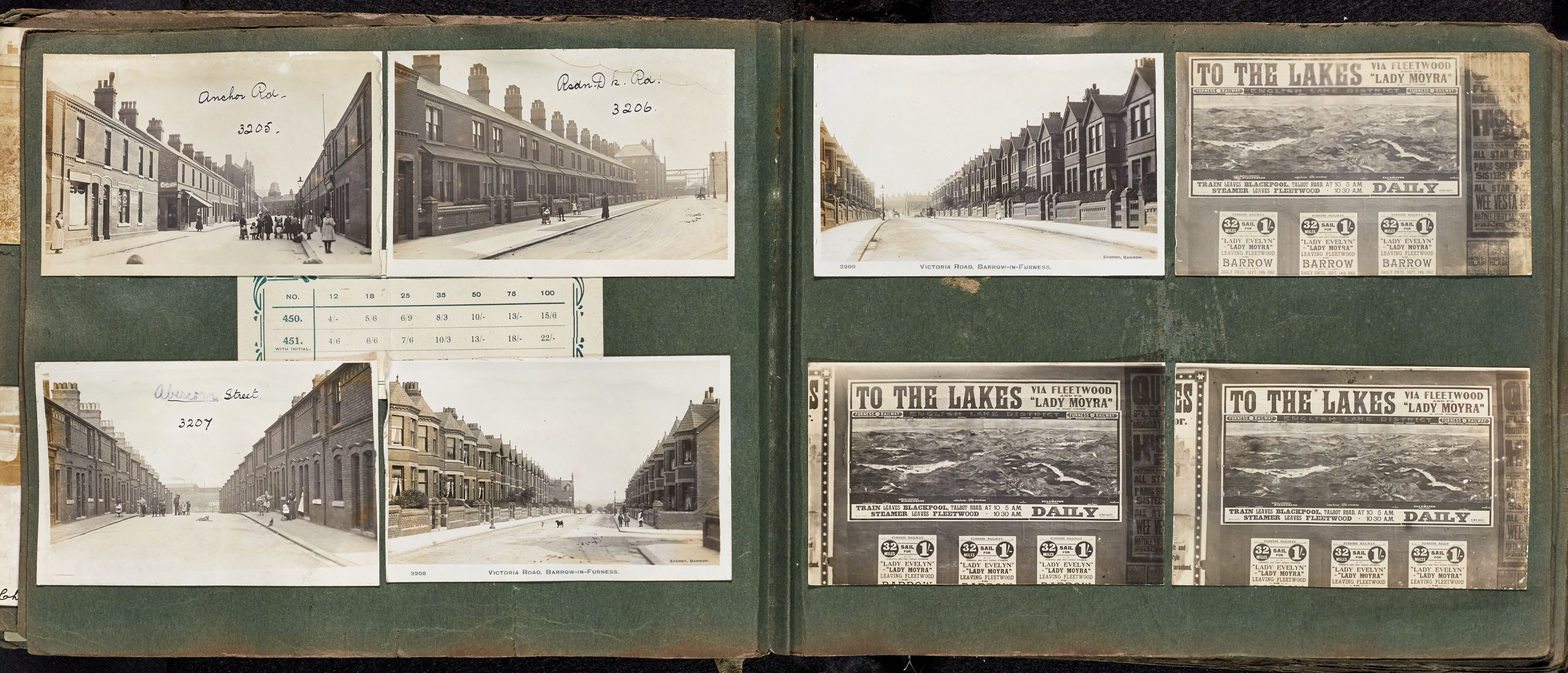
Album D4 4496-5043 Sankey Family Photographic Archive © Cumbria Archives
Album Number: Album D4 4496-5043
Page Number: 22

All Images on This Page
| Sankey Number | Image Title | Location Image Taken | Description |
|---|---|---|---|
| 4828 | The Schools | ||
| 4829 | Stankle Road | View West down road, Spring Bank behind. | |
| 4830 | Shore Cottages | ||
| 4831 | Cray Green | ||
| 4832 | Woodford | ||
| 4833 | Woodwell | ||
| 4834 | South View | ||
| 4835 | Woodwell | (vertical) | |
| 4836 | Bottoms Lane | ||
| 4837 | Cove Lane End. | Looking East, Cove Road to left and centre | |
| 4838 | View of Silverdale from Saint John's Church | ||
| 4839 | Calder Abbey | ||
| 4840 | Calder Abbey General View from North West | ||
| 4841 | Calder Abbey Looking West | ||
| 4842 | Calder Abbey From North | ||
| 4843 | Calder Abbey Drive |
Related Items
9536
6441